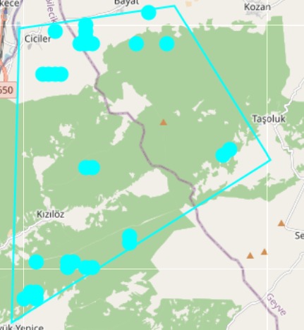
Risky Points
Identify ignition hotspots using historical fire activity, vegetation, slope and weather composites.
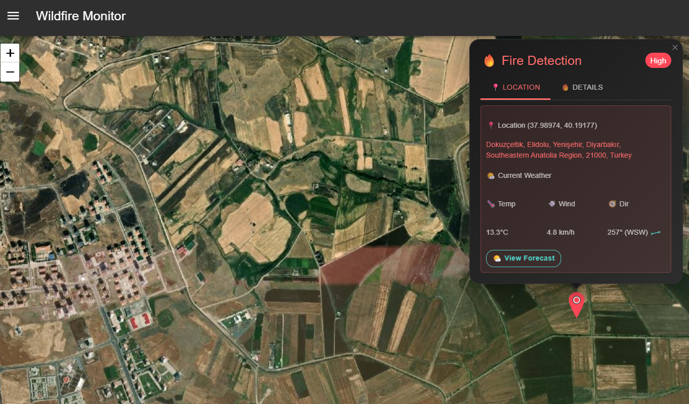
Satellite intelligence and predictive models that help detect risks, monitor wildfires, and keep communities safe.
Identify ignition hotspots using historical fire activity, vegetation, slope and weather composites.

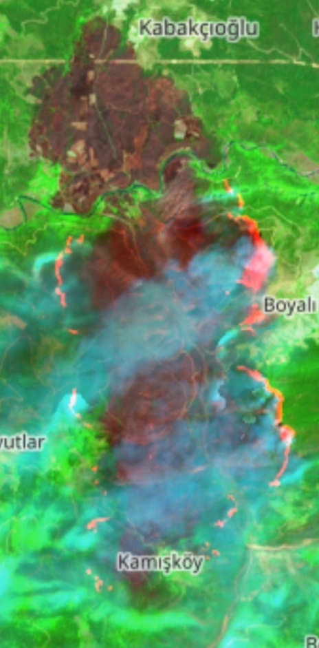
Automatic burn scar mapping from multispectral imagery for quick impact assessment and reporting.
Probabilistic spread projections combining fuel, terrain and forecast winds to support tactical decisions.
High-cadence satellite and aerial sources unified in one stream for operations and analysis.

Live dashboard with alerts, perimeter updates and resource tracking to keep teams aligned.
Drop us a line at contact@ottosi.com.